At a Glance
- Debby will soon move back over water off the Southeast coast and could restrengthen some.
- Extreme rain amounts could trigger serious flooding in Georgia and the Carolinas.
- Gusty winds, storm-surge flooding and a few tornadoes will continue to be impacts, as well.
- Moisture from Debby will enhance the threat of flooding along cold fronts in the Northeast.
Sign up for the Morning Brief email newsletter to get weekday updates from The Weather Channel and our meteorologists.
Tropical Storm Debby will soon move back over water where it could restrengthen some off the Southeast coast, but its main threat continues to be potentially historic heavy rainfall that could produce catastrophic flooding in parts of the Southeast the next few days.
Debby's moisture will also fuel a threat of flooding rain in the Northeast U.S. in the days ahead.
(LIVE UPDATES: The Latest On Debby's Impacts)
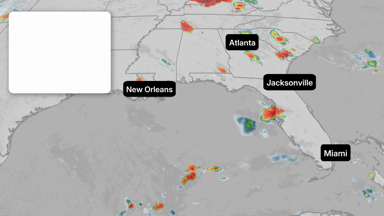
Here's where Debby is now and where it will head next. Debby is centered near Savannah, Georgia, as a tropical storm. It's spreading rain from southeast Georgia to eastern South Carolina and North Carolina, triggering flash flood warnings, including in the Charleston area.
Parts of the Charleston metro have seen near a foot of rain and more than 8 inches has fallen in the Savannah, Georgia.
Reported tornadoes caused damage overnight on Edisto Island and in Moncks Corner, South Carolina.
A tornado watch is in effect until 5 p.m. EDT from the middle South Carolina coast to southeast North Carolina.(MAPS: Rainfall Tracker And Historical Perspective)

Debby will soon move offshore of the Southeast coastal waters, where it will meander before sliding back inland on Thursday. While it could restrengthen some, the main result of the stalled forward motion is that its impacts in the Southeast, especially serious flooding, will be prolonged.
The slower a tropical system moves, the greater the rainfall. A study released last year by the NHC found rainfall flooding was responsible for the most direct U.S. deaths from tropical storms and hurricanes since 2013.

Major flooding is the number one concern with Debby going forward. The National Hurricane Center stated in their Tuesday discussion that "Debby is expected to produce potentially historic rainfall totals of 10 to 20 inches, with maximum amounts of 25 inches, bringing areas of catastrophic flooding across portions of the eastern half of South Carolina and southeast North Carolina through Friday".
Moisture from Debby will also fuel a threat of flooding the mid-Atlantic and Northeast U.S. along a pair of fronts with one sweeping through the region Tuesday, then lingering over the region into late week, followed by another front that will arrive Friday.

NOAA has issued their highest level of flood outlook called a high risk for the next few days, shown in pink on the maps below. These areas could experience damaging and life-threatening flash flooding and major river flooding.
(MORE: Why You Should Pay Attention To High Risk Flood Forecasts)
If you live in a low-lying flood-prone area, stay alert and follow the latest updates and warnings. Never attempt to drive through a flooded stretch of road or around barriers that signal a road closure. Over half of deaths in floods happen in vehicles, according to NOAA statistics.
Here's the timing of the most serious flood threat for the next few days, based on excessive rainfall outlooks from NOAA's Weather Prediction Center.
- Tuesday-Tuesday Night: eastern Georgia, middle and lower South Carolina and southern North Carolina, with a few bands of locally heavy rain lingering as far south as central Florida. Debby's moisture could also fuel flooding along a front in the Northeast, especially from around New York City to Philadelphia.
- Wednesday-Wednesday Night: extreme eastern Georgia to middle and lower South Carolina, eastern North Carolina and southeast Virginia

Thursday-Thursday Night: extreme eastern Georgia to central and eastern South Carolina, central and eastern North Carolina and central and southern Virginia
Friday-Saturday: At least localized flooding rainfall is possible as Debby's moisture gets pulled into another cold front from North Carolina northward to the mid-Atlantic and Northeast.

Tropical-storm-force winds continue to be a threat along the Southeast coast. Tropical storm warnings cover parts of southeast Georgia and South Carolina to southeast North Carolina as far north as Surf City, as shown below. The warnings include Charleston, South Carolina; Myrtle Beach, South Carolina; and Savannah, Georgia.
Tropical storm conditions (39 to 73 mph sustained winds) could last into Thursday night along the South Carolina coast. Those conditions are expected to arrive in the North Carolina warning area by early Wednesday.
Stronger wind gusts over 40 mph, coupled with increasingly soaked ground from heavy rain, will trigger more power outages, downed trees and tree damage.

Storm-surge flooding is possible in low-lying areas of the Southeast coast. Inundation from storm surge could reach 2 to 4 feet above normal tide levels if the peak surge arrives at high tide from the Georgia coast to southern North Carolina.
Not only that, the onshore winds on the Southeast coast might worsen rainfall flooding by not letting water drain out toward the ocean.

Here's a recap of Debby so far. Debby formed from a tropical wave the National Hurricane Center first started highlighting for possible development in the Atlantic on July 26.
Dry air kept it from developing for days as it tracked toward the northern Caribbean Islands. Tropical Depression Four then formed at 11 p.m. EDT on Aug. 2 near Cuba and strengthened into Tropical Storm Debby late on Aug. 3 in the southeast Gulf of Mexico.

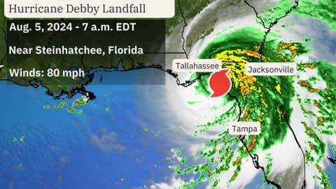
Debby intensified into a hurricane at 11 p.m. on Aug. 4 ahead of its landfall near Steinhatchee, Florida, on the morning of Aug. 5.

- Sunday's notable impacts: Wind gusts reached between 50 to 70 mph along the immediate Florida Gulf Coast in the evening, including a gust to 70 mph at the Skyway fishing pier in Manatee County. Gusts to 60 mph gusts were reported in Clearwater, Sarasota and St. Petersburg. Several feet of storm surge was reported from Fort Myers Beach to Cedar Key. More than a foot of rain fell in parts of western Florida, including the Sarasota metro area.
- Monday's notable impacts: Winds gusted over 60 mph in Florida's Big Bend region, with a top gust to 76 mph near Chiefland in Levy County. Moderate coastal flooding from a water rise 6 feet above normal was observed in Cedar Key. A rain-wrapped tornado downed trees, power lines and damaged structures in Edisto Beach, South Carolina, late Monday night, according to the National Weather Service. Downed trees and some downed power lines were reported across Berrien and Thomas Counties, Georgia. Rainfall totaled up to 13 inches in parts of north Florida near the track Debby's center. Flash flood emergencies, the highest level flood alert, were issued in north Florida's Baker, Columbia, Hamilton and Suwannee Counties. Flood water entered homes and other structures throughout Suwannee County, according to the National Weather Service. Flood water entered some structures in Valdosta, Georgia, early Monday evening. Street flooding was reported in parts of Charleston, South Carolina; and Savannah, Georgia, Monday.

